Sunday, January 16, 2011

Lonewolf Nunataks

It blew hard all Friday night (~30 knots) but by early morning (Dec 18) the winds had subsided. John and Braydon picked us up with their Twin Otter and we flew north and west of our camp to the Lonewolf Nunataks. These nunataks are the farthest north we sampled out of CTAM and are actually slightly closer to McMurdo than CTAM. It was an exceptionally beautiful day on the edge of the Polar Plateau and the Byrd Névé. With our level of dress, however, it was too hot much of the day—and perhas with temps as high at 20°F.


Monday, January 10, 2011

Turret Nunatak

Friday morning (Dec 17) it is was clear but with strong winds blowing off the polar plateau. The forecast was for winds over 30 knots in the vicinity of Lonewolf Nunatak so we decided to head for the Turret Nunatak. The target site was in the lee of the nunatak so the thought was that the winds should be manageable there. So John and Bradon flew into our windy Ascent Glacier camp mid morning and off we went to the Ascent Glacier. As it turned out, this was an exceptional day with good weather (out of the wind), good geological samples, and extraordinary scenery.


On the way out from camp we flew over the elongate rat-tailed moraine separating the Ascent Glacier (on the right) from the Argosy Glacier (on the left). In the background is the confluence with the Marsh Glacier.

A view of the confluence of the Argosy and the much larger Marsh Glacier.

A view of the Marsh Glacier further downstream.

Confluence of the large Marsh Glacier (background) with the even larger Nimrod Glacier (foreground). Mountains of the Queen Elizabeth Range in the distance. By the time the Marsh joins the Nimrod, some 35 miles or so from the Ascent Glacier camp, the ice is on a rapid charge to the Ross Sea Ice shelf. The glacier ice is heavily crevassed here indicating it is under great tension as it falls away to the ice shelf.

Crevasses on a portion of the Nimrod Glacier.

The Twin Otter landed on the blue ice and taxied close to the Turret Nunatak. All blue ice from hear so it was crampon time. We readied the gear for the day of collecting.

The pilots quickly wandered off over the blue ice into the distance.

The steep rolling hills of blue ice made the crampons essential.

John said the clasts came from “that a way+. Dylan peers carefully into the distance.

The moraine was on the edge of very cool steeply rolling hills of blue ice.

Slope of blue ice in the foreground.

Beautiful blue ice setting for the Twin Otter.

The ceremonial gathering of the clasts.

Tanya heads to the plane at the end of the day.

Our fearless pilots John and Bradon.

Confluence of the Marsh and Nimrod Glaciers.

Frozen melt pools in the Nimrod Glacier ice.


A small glacier flows slowly into the raging Nimrod.

Flow lines around the Kon-Tiki Nunatak in the middle of the Nimrod Glacier.

Broken up ice and crevasses in the lower Nimrod Glacier.

Back-eddy flow into main stem glacier.

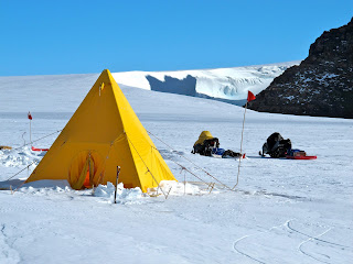
But when we returned to our camp, the wind was blowing, just as we left it. So, I decided to build a wind wall in front of my tent to prevent reduce further drifting.

Saturday, January 8, 2011

Field day in the Miller Range sampling clasts at the head of the Argosy Glacier

We had no scheduled air support on Thursday (16 Dec) so we took advantage of the reasonable weather to sample a moraine in the next valley over at the head of the Argosy Glacier. It was cold and there was some wind and blowing snow, but it was clear and sunny and we had good luck collecting a wide variety of interesting clasts as was the case the day before.

The Argosy Glacier is in the next valley over to the west--around the big wind scoop to the right. This wind scoop is an extraordinary feature with very steep walls of blue ice well over 100 feet high. The presence of wind scoops on either side at the head of the Ascent Glacier indicates that strong winds off the polar plateau is a persistent feature here (the day this picture was taken—not Dec 16--the winds were light). Our route was up the middle of the Ascent glacier and around to the right because crevasses were seen closer to the wind scoop.

Our comfort station (Scott tent) in the foreground.


Although it looks close in this photo, the wind scoop is over a mile away from camp. When looking at the terrain here from a distance it looks like it would be easy going on the skidoos—that you could open up the throttle and cover some large distances quickly. Unfortunately, this is not the case. The wind blown snow is exceptionally hard and the snow machines go over every bump rather than ride down through them. The scalloped blue ice is much harder to go over and require slow speeds. In addition, we have 3 snowmobiles for 5 people, and two people have to ride in the sleds behind the snowmobiles. Any significant speed would rattle them quickly to pieces. All of this means that it is slow going in this terrane and not very pleasant if you are in the back of the sled.

We sampled the glacial clasts on the wind-swept blue ice on the polar plateau side of the Argosy Glacier.

The crew takes an initial inventory of clasts at the Argosy site. It was cold with a persistent wind blowing off the polar plateau—a common theme here.

Wind-swept glacial clasts in the blue ice.


Snow blowing across the clast-spotted blue ice.

Mark Fanning scouring the glacial deposits for interesting and different clasts.

A view from the top of the Argosy Glacier. Interestingly, we saw a fair number snowmobile tracks on the windblown hardpack snow here, despite a wind that blows nearly constantly. There had not been anyone in this area this year, which indicates how some signs of human activity can last an extraordinary long time in places in Antarctica.

Another view of the Argosy Glacier showing an end moraine part of the way down the valley and the glacier flowing off to the right in the background.

On the way back to camp we went to a small nunatak at the head of the Ascent Glacier. There was a PoleNet geophysical station on the nunatak. The solar and wind power for the battery pack powering the equipment is shown here. One of the little wind generators on the right top had been ripped off by high winds some time in the past.

Looking at the basement rocks on the South end of the nunatak. The blue ice of the southern edge of polar plateau is just beyond the nunatak. Further in the background is the polar plateau. There is nothing but ice (mostly snow covered) from here to the South Pole (and beyond).

A view of our humble little camp from near the head of the Ascent glacier.

Back in the Arctic Oven at the end of the day. Dylan and John enjoy a cup of tea while Mark works on dinner.